THE ROCKS OF YZERFONTEIN
Duncan Miller
Yzerfontein village is built on and around a rocky promontory on the West Coast, about 70 km north of Cape Town. On a clear day Table Mountain is visible in the distance to the south, and Dassen Island closer by to the west. The rocky shore is dramatic, cut by deep gullies, and north of the town there is the pristine Sixteen Mile Beach, stretching all the way north to the Langebaan Peninsula. But apart from the scenery, and Rosemead Artisanal Bakery, a visit to Yzerfontein is justified by the outcrops along the coast. These are various dark igneous rocks, crystallised from a magma that intruded deep into the crust some 535 million years ago, in a succession of pulses to form the so-called Yzerfontein Pluton. This multi-phase body solidified slowly to produce medium- to coarse-grained rocks ranging in composition from gabbro, through monzonites, to syenite. These are quite distinct in appearance, chemistry and mineralogical composition from the well-known Cape Granites, although they are thought to be the product of the same continental collision and mountain-building event in the assembly of the Gondwana supercontinent. To download Duncan’s illustrated description and read more about these fascinating rocks click here.
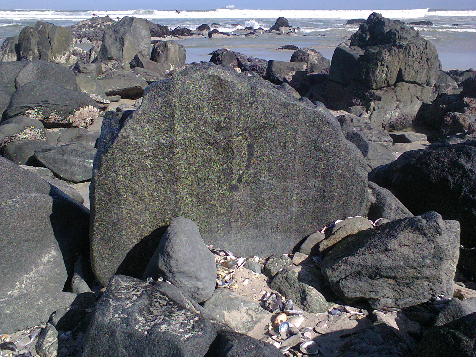
The rocks of Rooipan se Klippe, also known as Gabbro Point, north of Yzerfontein beach, with magmatic banding due to alternating concentrations of lighter feldspar and darker pyroxene minerals
Stories in Stone
The Cape Town Tin Mines
This month we are going to do all three, recycle an old publication, reuse it with additional photographs, and repurpose it as an article on the club’s website. The article describes Cape Town’s former tin mines, and the website article has a virtual tour of the Vredehoek tin mine on Devil’s Peak, courtesy of Dr Gregor Borg of Halle University in Germany. All of this is available for download from here.
A Short Geological History
of the Southwestern Cape
Duncan Miller
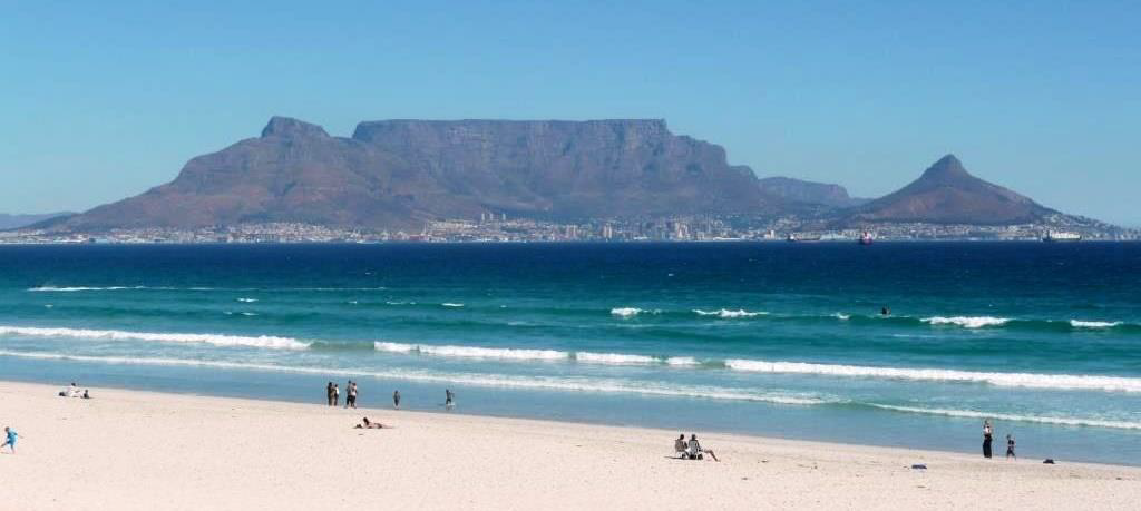
Cape Town’s Table Mountain is a geological wonder. Carved by erosion, its sandstone cliffs rest on a base of granite. It is one of the most famous landmarks in the world. The Cape Peninsula’s sandstone hosts a shrinking remnant of fynbos, the uniquely rich flora that has evolved on the nutrient-poor sandy soils. But how many people know that Table Mountain’s flat top marks the passage of a long vanished glacier, or that the black rocks at its base once were mud at the bottom of an even more ancient sea? How many people know that the granites at Sea Point were visited in 1836 by Charles Darwin during the homeward voyage of the Beagle, and that it helped to resolve a long-standing debate about the origin of granites world-wide? These various rocks have diverse origins. Their stories can be read by those who have the curiosity and the patience to learn the language of geology.
The rocks of the Western Cape are the remnants of two distinct mountain building episodes, both of them associated with the assembly of the latest supercontinent, Gondwana. In order to follow the historical sequence of deposition, collisions, and mountain building you need to be able to recognise three different packages of rocks. The oldest package consists of the Malmesbury Group metamorphic sedimentary and volcanic rocks, about 550 million years old. (All geological dates are approximate because they are associated with a statistical error. This usually is around plus minus one percent of the quoted age.) The igneous Cape Granite Suite, consisting of various rock bodies ranging in age from about 550 to 520 million years, is intrusive into the Malmesbury Group rocks. Uplift in a mountain building event and then rapid erosion of these two groups of rocks was followed by deposition of the Cape Supergroup sedimentary rocks. Folded and eroded remnants of these form the prominent Cape Fold Belt mountains.
I have written a short account of this geological history, which describes these three packages of rocks in more detail. It is intended for readers who want to know something about the geological history of the Western Cape, but who have no formal training in geology. This account, illustrated with some photographs, is available on the club’s website here.
The geological record may be read like a book, but it is a book from which many pages, and indeed whole chapters, are missing. Geologists spend a great deal of time describing rocks in detail, but because the geological record of past events is incomplete the evidence can be ambiguous. Consequently, it is difficult to construct a single coherent story. Many reconstructions of past geological events must be tentative. This is necessary, to avoid giving the impression of false certainty. It also means that often there is not only one story that can explain the available evidence. Where geologists’ opinions differ fundamentally in their interpretation of the rocks, there is more than one story to tell. Geological explanations change from time to time, and so the reconstructed stories of the past also change to accommodate new evidence. As a result, there may be some discrepancies between my explanations and those in earlier geological publications. Because this is not an academic text, I do not debate the merits of any particular version of the past, but try to present the most coherent story based on the published evidence currently available.
The online text is as free of technical jargon as possible, but there are some fundamental geological concepts you need to comprehend in order to understand geological history. They include the rock cycle processes of weathering, deposition, metamorphism, igneous intrusion, melting and volcanic eruption. The mechanism underlying these is plate tectonics, the ongoing, heat-driven cycle of continental rupture and collision that creates most volcanoes, ocean basins, mountain chains and continents. For a more detailed account of the major geological processes the reader is referred to the excellent introductory book ‘The Story of Earth and Life’ by Terence McCarthy and Bruce Rubidge and their contributing authors (2005). Two books dealing specifically with the geology of the Western Cape are ‘The Rocks and Mountains of Cape Town’ by John Compton (2004) and ‘Geological Adventures in the Fairest Cape: Unlocking the Secrets of its Scenery’ by John Rogers (2018). The introductory section of ‘50 Must-see Geological Sites in South Africa’ by Gavin Whitfield (2015) describes Earth processes and it also has a good introduction to the rocks of the Western Cape. More detailed information about the local geology is available in the published explanations to the 1:250 000 geological map sheets 3318 (Theron, Gresse, Siegfried and Rogers 1992) and 3319 (Gresse and Theron 1992), and the explanation to the 1:250 000 metallogenic map sheet 3318 (Cole 2003). These may still be available from the South African Council for Geoscience, Private Bag X112, Pretoria, 0001 and some of its regional offices.
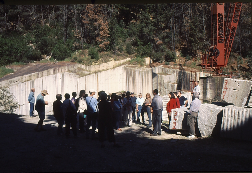
A tour group from the club visits the Clift granite quarry at Paarl (photograph by Duncan Miller)
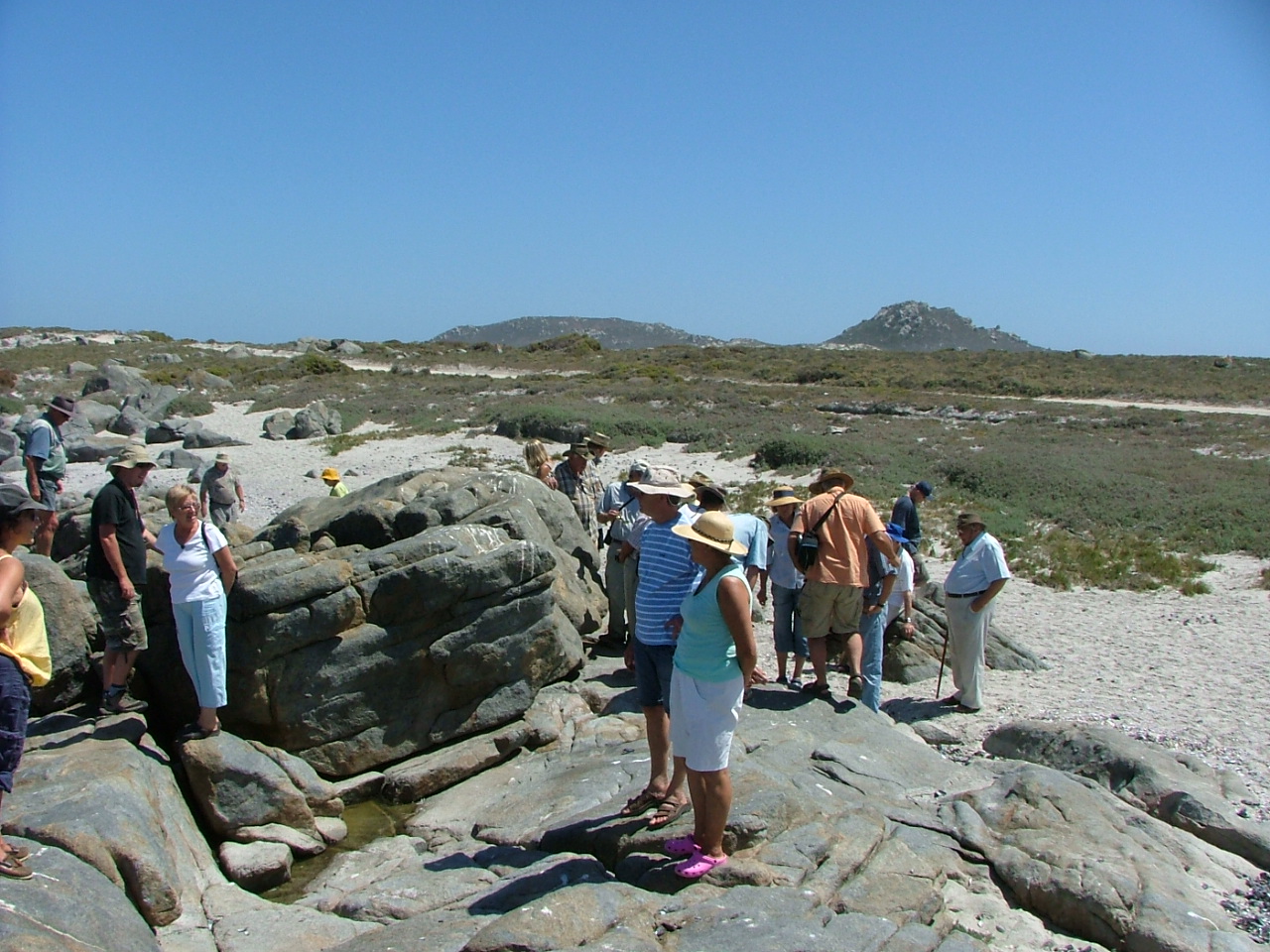
A tour group from the club visits the outcrops of rhyolitic lava at Postberg on the Langebaan Peninsula (photograph by Amour Venter)
A Tour of Robben Island
Robben Island has a rich history –inter alia a hospital colony, political prison, museum, bone of contention, penguin colony, crayfish poachers’ target, and source of building stone. The entrance to the Castle of Good Hope is decorated with slabs of Malmesbury slate from Robben Island, as are the steps of the several other historic buildings in Cape Town. This slate originated from two different quarries, the so-called Van Riebeeck’s Quarry at the southern end of the island and the Rangatira Quarry on the western seashore. Private tours are not allowed on the island but you can learn a lot about its geology from following a geological description on Google Earth. This month you are encouraged to download Duncan’s geological description from here, fire up Google Earth and enlarge its image of Robben Island on your computer screen, and then following Duncan’s description tour the island in the convenience of your home.
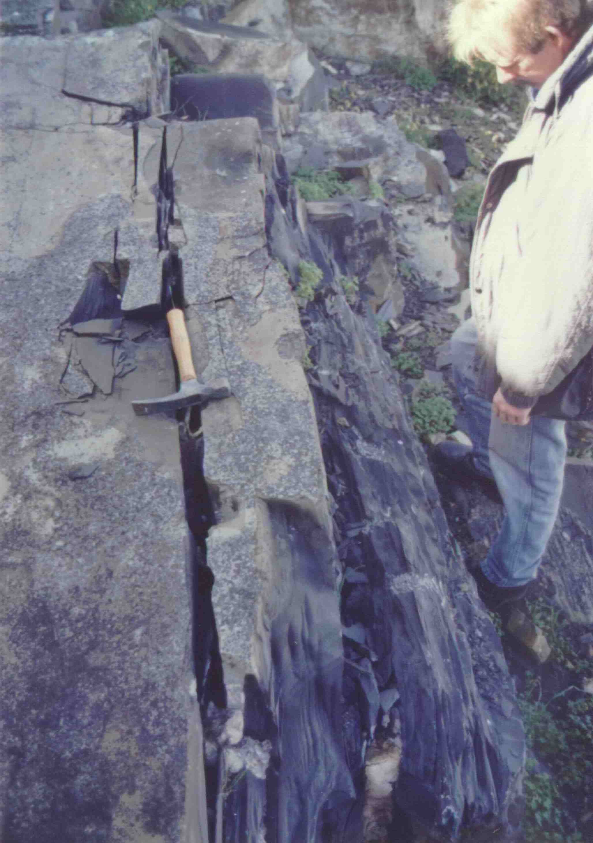
Archaeologist David Halkett contemplates sampling the slabs of Malmesbury slate in Van Riebeeck’s Quarry at the southern end of Robben Island. Petrographic analysis at the University of Cape Town has shown that this quarry was the source of rock for the entrance of the Castle of Good Hope.
West Coast Story – A Tour From Cape Town To Cape Columbine To Look At Granitic Rocks
Duncan Miller
The West Coast has a wonderful array of granitic rocks. They range from coarse-grained rocks with feldspar crystals the size of match boxes that solidified at depths of over 10 km, to fine-grained volcanic rocks that erupted on the surface over half a billion years ago. Since then they were covered by several kilometres of sedimentary rocks. These conveniently have been eroded away to expose what were once the roots of an enormous, now vanished, mountain chain. The downloadable file on the club’s website click here describes these rocks exposed along the West Coast, with lots of photographs of exposures you can visit yourself one day with only a few metres walk from your car.
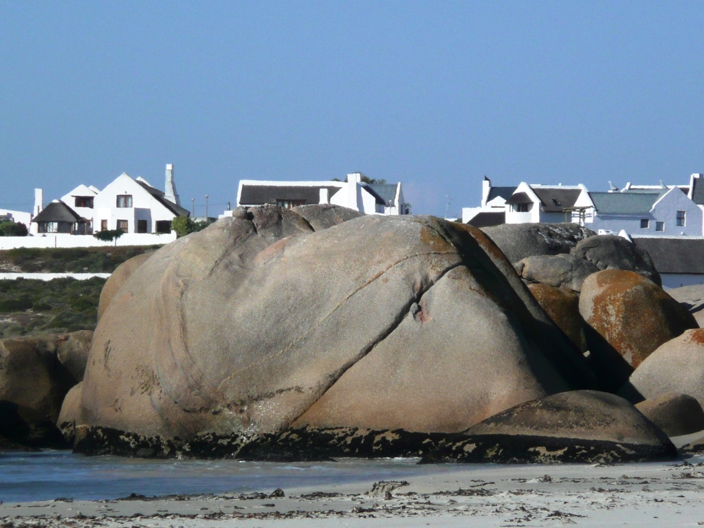
A boulder of Vredenburg Granite at Paternoster on the Vredenburg Peninsula
The Cape Fold Belt
Duncan Miller
The Cape Fold Belt is the spine of the Western Cape. It forms a chain of mountains comprising the Cedarberg in the west, the Hottentots Holland Mountains and Steenbras Mountains near Cape Town, and stretches eastwards in the form of the Langeberg and parallel ranges. In the west the Cedarberg ranges are fairly gently folded, with their sandstone and shale rocks eventually plunging under the Karoo cover further inland. In the central portion and eastern parts of the Langeberg the deformation of the sandstones and associated shales is intense, sometimes even overturning the originally horizontal layers of these sedimentary rocks, and in places shunting them over each other to create thickened piles. The forces necessary for this came from continental collisions far to the west and south, during an episode of formation of the Gondwana supercontinent. To read Duncan’s description of these dramatic geological events click here.
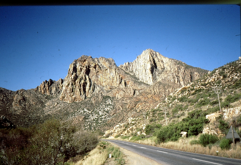
The spectacularly contorted and now vertical sandstones exposed in Kogman’s Kloof near Montagu, in the Langeberg mountains of the eastern arm of the Cape Fold Belt
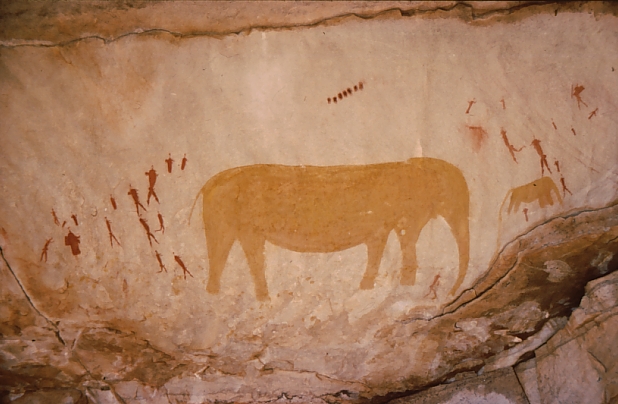
South Africa has a rich legacy of rock art. Rock paintings, done mostly by former hunter-gatherer communities, can be found in numerous sandstone overhangs, shelters and caves throughout the country. Rock engravings were done on exposed dolerite or limestone boulders in more arid areas without rock shelters. This guide illustrates the wide variety of rock art in the Western and Northern Cape provinces, but for heritage conservation reasons does not provide details of locations. To read further click here.